Project RISE

Project rise was successfully completed in November 2021; another step towards enabling the future scale of bvlos and other flights in non-segregated airspace.

Project RISE was within Phase 2 of the Future Flight Challenge, funded by Innovate UK, part of UK Research and Innovation, through the Industrial Strategy Challenge Fund. Dronecloud led a consortium composed of key industry partners, including Sky-DronesCranfield UniversityFrequentis and Skyports.

Project RISE was focused on the approvals process and traffic management for flying within airspace controlled by an Air Navigation Service Provider (ANSP), integrating across a combined stack of independent software and hardware. 

default

“Unlocking the future of drone operations through integration.”

The project outputs allow automated transfers of information and communications between a drone operator and the airspace controller via a Ground Control Station (GCS), Uncrewed Traffic Management Service Provider (UTMSP) and Air Traffic Management (ATM) interface.

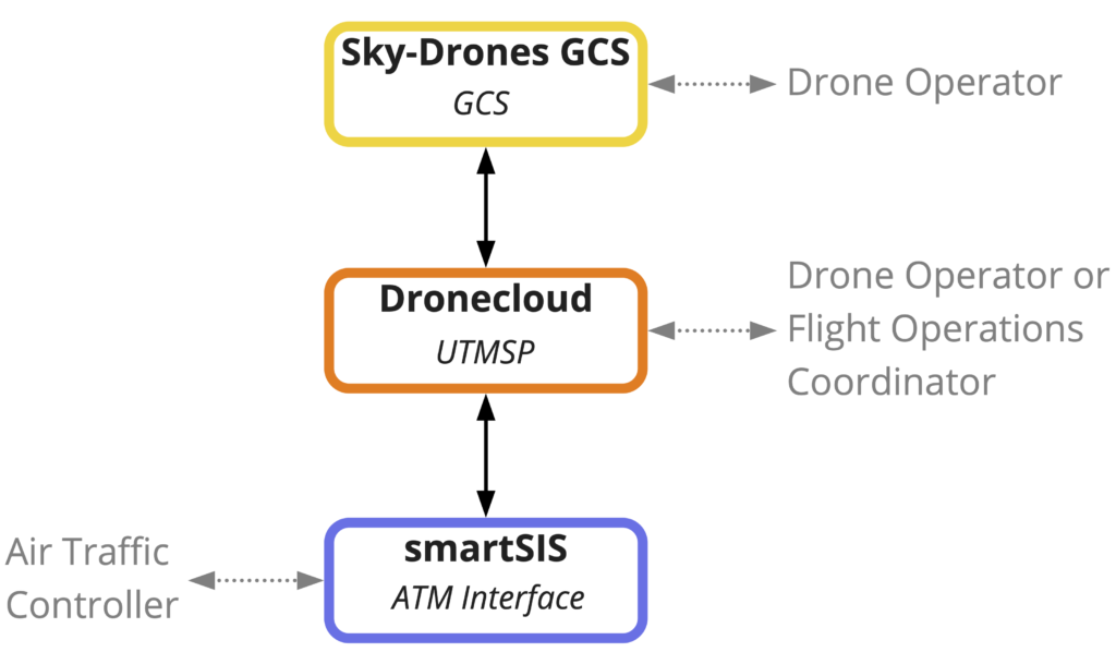
Through integrations between these systems, we can share automatically electronic ID, flight telemetry data, alerts and other communications, with a view to developing full Network Remote ID (Net-RID). This streamlines approval and traffic management, breaking down barriers to scale. At the same time, it readies the software platforms towards participating in all UTM regulatory frameworks, such as the UK’s Open Access UTM Framework and U-Space.

Rather than creating a proprietary closed stack of UTM services within a single platform, RISE demonstrates an open approach to delivering a range of UTM services across multiple integrated platforms in a flexible and inclusive way. Integrations were delivered through open standard Application Programming Interfaces (APIs), allowing other GCS, drone manufacturers and providers of UTM services to connect in through these integrations. 

Cranfield University completed an analysis of radio link connectivity in a UAS system to highlight the factors which affect connectivity performance needed for BVLOS, together with mitigation plans to improve it.

Read the Cranfield Report on Radio Link Analysis here

Project Outcomes

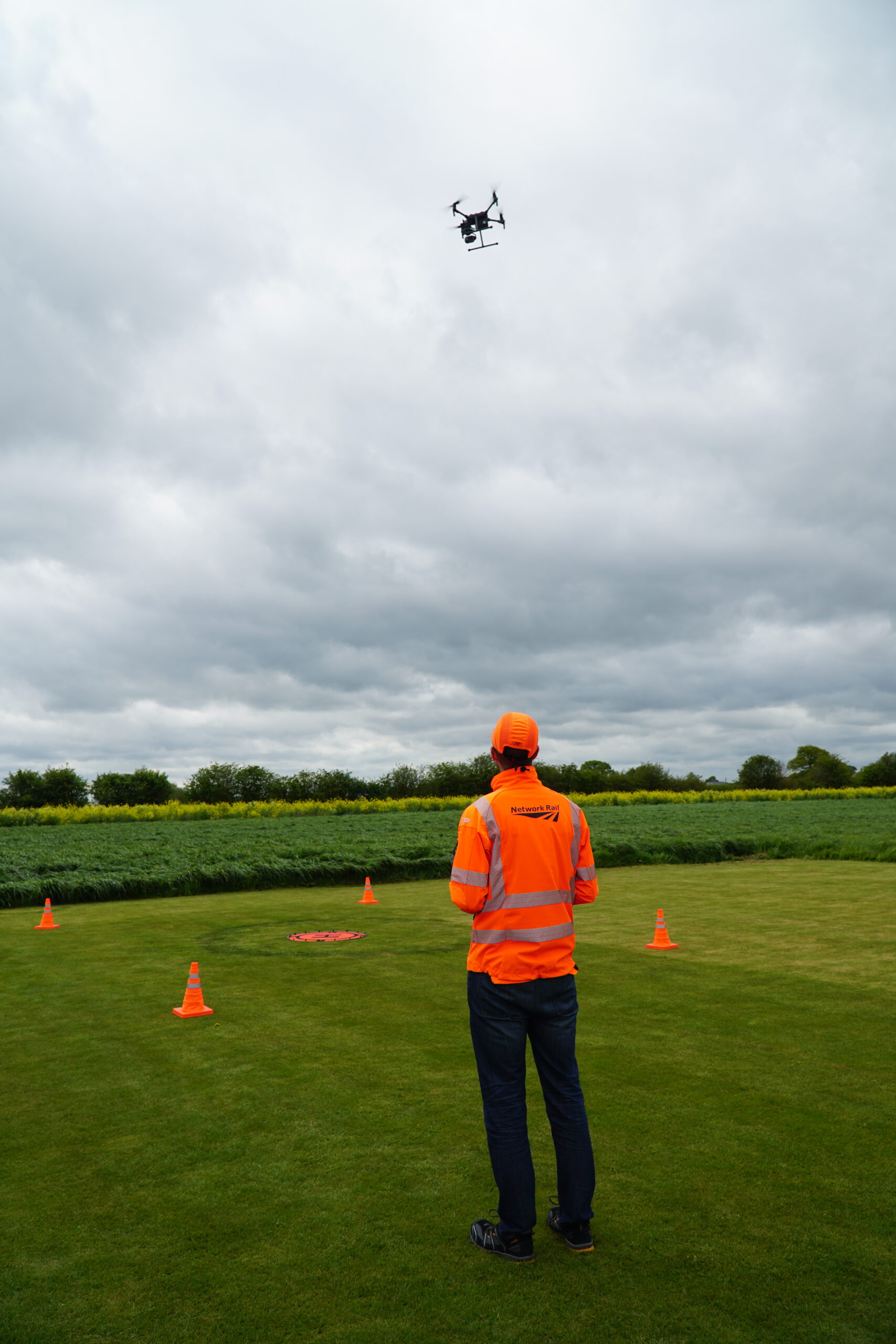
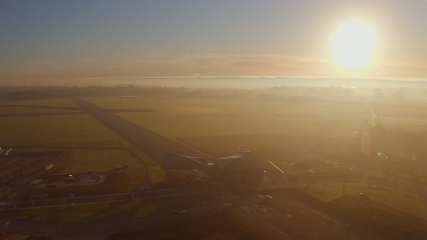
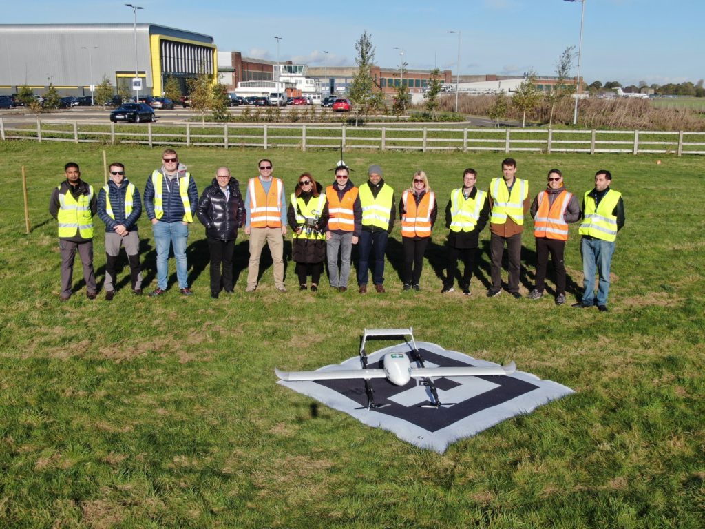
The project produced a proof of concept for automated integration of systems needed for planning and carrying out BVLOS and other flights in non-segregated controlled airspace, including achieving necessary approvals from airspace controllers. Our example use-case is an airport environment where ATC needs to simultaneously control both drones and traditional air traffic. At the end of the project, we carried out field trials at Cranfield Airport in the UK.

After Project RISE, user accounts and aircraft can be linked between Sky-Drones GCS and Dronecloud, feeding electronic ID and telemetry data from Sky-Drones to Dronecloud. If a flight is planned within an area requiring approval via Frequentis’ smartSIS, flight plans are sent automatically by Dronecloud to smartSIS for approval. Approval status and alerts are tracked and displayed to the Dronecloud operator. Flights can be seen and tracked in Dronecloud’s Live View, with a message centre and interactive buttons to allow a pilot or flight operations coordinator to carry out two-way integrated communication with the relevant ANSP. All significant events and communications are logged.
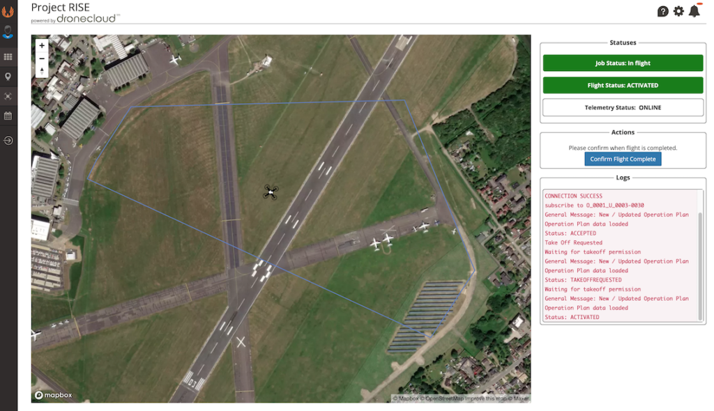
Field Trials

Multiple scenarios were tested successfully, some with more than one drone in the air at the same time. Multi-rotor and fixed-wing aircraft were used.

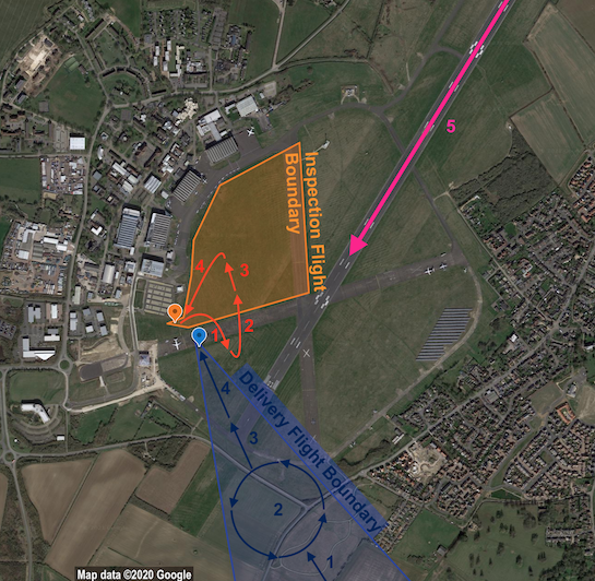
EXAMPLE SCENARIO – TWO AIRCRAFT IN AIR, ONE NON-CONFORMING, FOLLOWED BY AN AIRSPACE EMERGENCY

An inspection flight and a delivery flight were separately planned in Dronecloud for two aircraft to fly at the same time but not spatially overlapping. Dronecloud automatically sent flight plans to smartSIS for approval. ATC were happy with both flights and approved them in smartSIS. Both pilots could see in Dronecloud that their flights were approved, and so requested take-off. ATC approved take-off for both in smartSIS, and the flights commenced.

1. During flight, the inspection flight left its approved boundary. This potentially caused a hazard to the delivery aircraft. 

2. smartSIS detected non-conformance and automatically sent an alert to the inspection pilot. ATC sent an alert to the delivery pilot from smartSIS to Dronecloud, asking to loiter in place.

3. ATC could see in smartSIS when the inspection flight acknowledged and returned to its flight plan. ATC sent a new message to the delivery pilot from smartSIS to Dronecloud to confirm now safe to proceed. Both flights proceeded with their plans.

4. A crewed aircraft requested from ATC an emergency landing. ATC pushed a button in smartSIS that set an area-wide No Drone Zone (NDZ) and automatically sent an alert to all drone pilots in Dronecloud to land immediately. Both drone pilots acknowledged and landed their aircraft.

5. The crewed aircraft was able to land safely in clear airspace. 

Network Rail

Network Rail chooses Dronecloud flight management system to help manage their entire drone operation

“With the number of drone flights at the level it is and only going to climb higher in the future, we needed a flight management system to manage the load to ensure we are as efficient and safe as possible. It will show drone pilots if another drone is operating nearby, as well as alert the pilot to other potential ground or air hazards in the area of the flight.”

Rikke Carmichael, Head of Air Operations.

When an organisation responsible for the rail infrastructure across an entire country put drones to work at scale, we see the true value of a flight management system that enables it.

Network Rail have spent several years developing one of the largest drone teams in Europe. During this process they have had a great deal of experience of both the benefits the technology brings and the challenges their operations team face on a daily basis. This experience informed the tender they put out in mid 2020 with the aim of finding the best flight management system on which to build their requirements.

No software currently existed to meet the exact requirements of Network rail but through a rigorous tender process, Dronecloud was chosen as the best FMS on which to develop these requirements. Thankfully, the knowledge and vision of the team at Network rail means that most, if not all of the development required will be beneficial to the rest of the platform, its users and to the rest of the industry.

Increased Safety

One of the major benefits of using drones to carry out a multitude of tasks is the removal of humans from near the line network. Dronecloud is facilitating the growth of safer operations.

Rikke Carmichael, head of Air Operations, said: “With the number of drone flights at the level it is and only going to climb higher in the future, we need a system like this to manage the load to ensure we are as efficient and safe as possible. Dronecloud shows our pilots if another drone is operating nearby, as well as alerting the pilot to other potential ground or air hazards in the area of the flight.

As Enterprise deployments of drones are now being rolled out  across industries to survey and monitor sites at previously unknown  levels we need new tools to manage them. The use of drones, however, comes with its own complexities, amplified when scaled. The partnership between Dronecloud and Network Rail is set to open up new workflows to achieve safe and regulated operations in complex environments.

Rail UTM

Dronecloud is helping Network Rail to rapidly scale is drone operation with their pilots safely increasing the number of drone flights by over 300% in less than a year. The trend is set to continue over the next few years.

Whilst Dronecloud is helping increase drone activity for Network Rail today, the partnership is working hard to develop the system of the future. By bringing technologies and UTM services together, we’re helping to create a “local” UTM ecosystem around the rail network and helping Network Rail achieve greater capabilities, such as Beyond Visual Line of Site (BVLOS) track inspections – a game changer for the productivity of drone operations.

“Network Rail is the perfect partner for us. We have a shared vision of the efficiencies that well managed drone operations can give to infrastructure projects. Network Rail has demonstrated that it is forward-thinking, and its team understands the challenges and complexities of enterprise scale drone operations, so we are well aligned on where we can support them now, and in the future.” 

Jan Domaradzki – CEO Dronecloud

External Flight Approvals

Since coming online in January 2021, the service has seen an increase of 500% in the number of flight plans to Network Rail for approval.

The UK has a busy and dense rail network, where many drone companies operate drones near the track. The combination of Network Rail’s growing drone fleet plus external drone operators needing to fly near rail infrastructure means the requirement for visibility of who is flying what and where becomes paramount.

Historically, the Air Operations team at Network Rail received flight plans by email and the labour intensive process for approval took 10 days. As a result, Network Rail and Dronecloud worked together to implement a ‘first of its kind’ approval service for all drone users in the UK.

Since adopting Dronecloud Network Rail has seen the number of external flight approvals increase by 500%.

 All drone operators seeking to fly drones over or near Network rail infrastructure are advised to submit their flights plan via the digital flight approval process powered by Dronecloud.

It’s a quick and easy process requiring basic flight details and a risk assessment. The tools and templates to do this are built into Dronecloud with an intuitive step-by-step workflow guiding you along. Approvals are typically given with 24 hours, often within hours.

The solution to deconfliction has been in part to connect the flight approval and flight planning processes in Dronecloud to Altitude Angels Guardian UTM, already widely used by UK drone users via the NATS Drone Assist safety app and long term partners of Dronecloud. 

For a first hand insight to Network Rail Operations and partnership with Dronecloud, please spend a few minutes to watch the video below as Air Operations mangers discuss operations in a public forum.

“With the number of drone flights at the level it is and only going to climb higher in the future, we needed a flight management system to manage the load to ensure we are as efficient and safe as possible. It will show drone pilots if another drone is operating nearby, as well as alert the pilot to other potential ground or air hazards in the area of the flight.”

Rikke Carmichael, Head of Air Operations Network Rail

We’ve been waiting a while for something like this. Finally, a business focussed software solution for drone operations. We now run all our work through Dronecloud, it has given our team complete oversight of all our jobs and we have made great gains since moving on to the platform.

Seth Zora, President Aerdia LLC

“The workflow is the best we’ve seen in any platform of its kind and we are now able to manage our operational teams, clients and compliance in one place with a new level of ease.”

Mark Jones RUAS

“Dronecloud has allowed EM3 to reduce the amount of time taken in mission planning, speeding up our whole pre-flight workflow. It gives us the confidence to know that all the relevant/correct checks are being carried out and allows us to easily hand over a detailed RAMS document to the client without duplicating processes”

Ross Smith, EM3 Solutions